
Dhaka Thrive: Transforming Urban Resilience Through Geospatial Innovation
Rahul Mathew shows how innovative technology approaches mean that informal settlements aren't left out when it comes to urban planning
In a city as dynamic and densely populated as Dhaka, the challenges of urbanization are profound. With over 22 million residents, including millions living in informal settlements, the capital of Bangladesh faces significant risks from climate change, natural disasters, and public health crises. Yet, the tools for understanding and addressing these vulnerabilities remain limited, particularly in areas where infrastructure and services are critically needed. Dhaka Thrive is addressing this gap, leveraging geospatial technology and community-driven data collection to create a new model for urban resilience.
The Challenge: Unseen and Underrepresented
Dhaka’s informal settlements are home to some of the most vulnerable populations, yet they are often overlooked in city planning. Traditional mapping systems and urban planning tools fail to capture the dynamic nature of these communities. Factors like waste accumulation, flooding, fire hazards, and inadequate infrastructure vary drastically across these settlements, requiring hyper-local data to inform effective interventions. Without accurate and actionable insights, millions are left exposed to risks that could otherwise be mitigated.
A Participatory Approach to Mapping
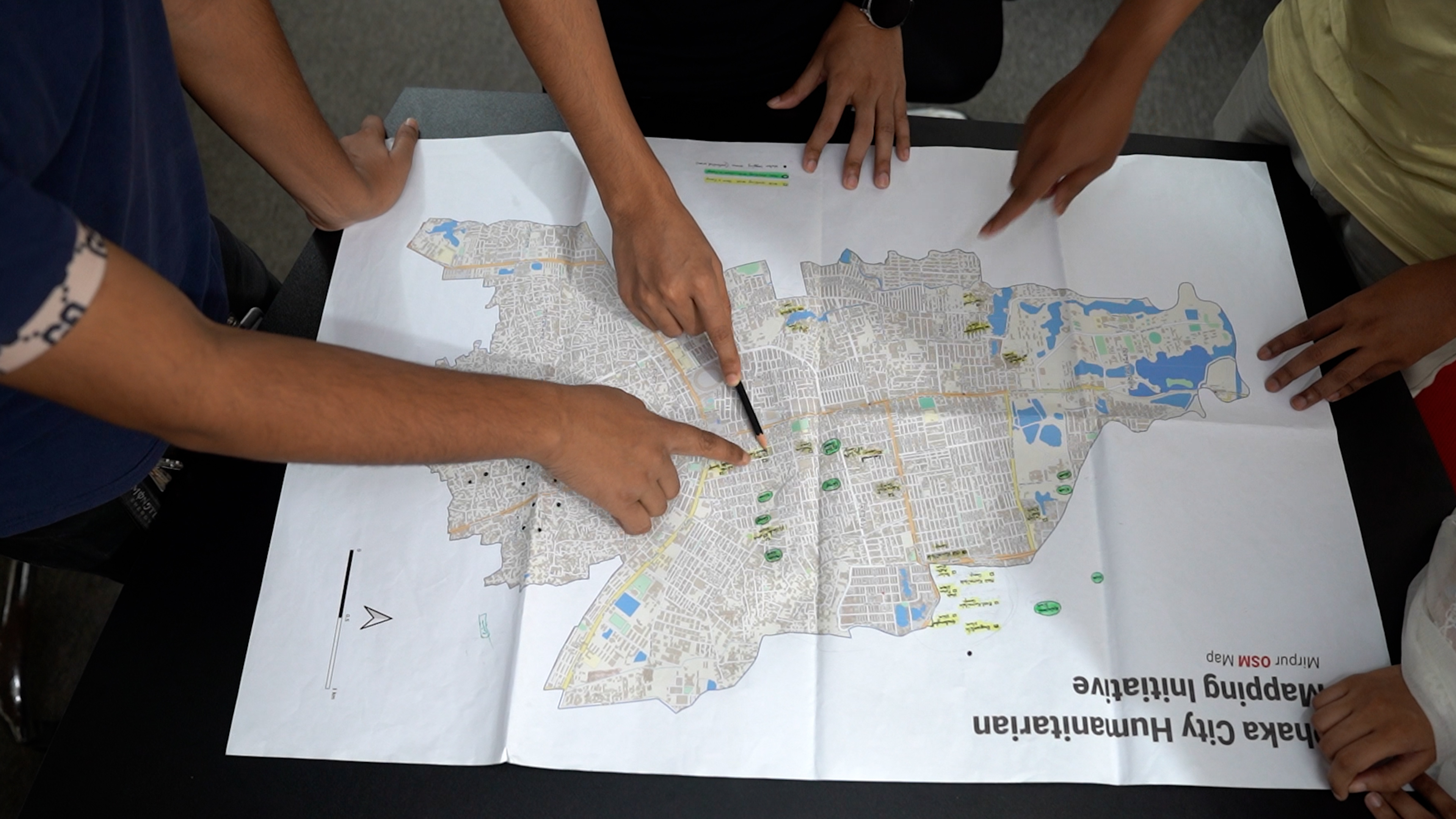
Dhaka Thrive introduces a groundbreaking approach to urban planning by involving local communities in the mapping process. Using open-source geospatial tools like OpenStreetMap, the project trains youth and residents to collect real-time data about their neighborhoods. This participatory mapping ensures that the realities of life in informal settlements are not only captured but also recognized as integral to planning and decision-making.
Key to this approach is the empowerment of local youth, who are trained in geospatial technology and data collection techniques. These youth mappers serve as agents of change, collecting and updating data that reflects the needs and vulnerabilities of their communities. In doing so, Dhaka Thrive creates a sustainable system for ongoing data collection and urban resilience planning.
From Data to Decision-Making
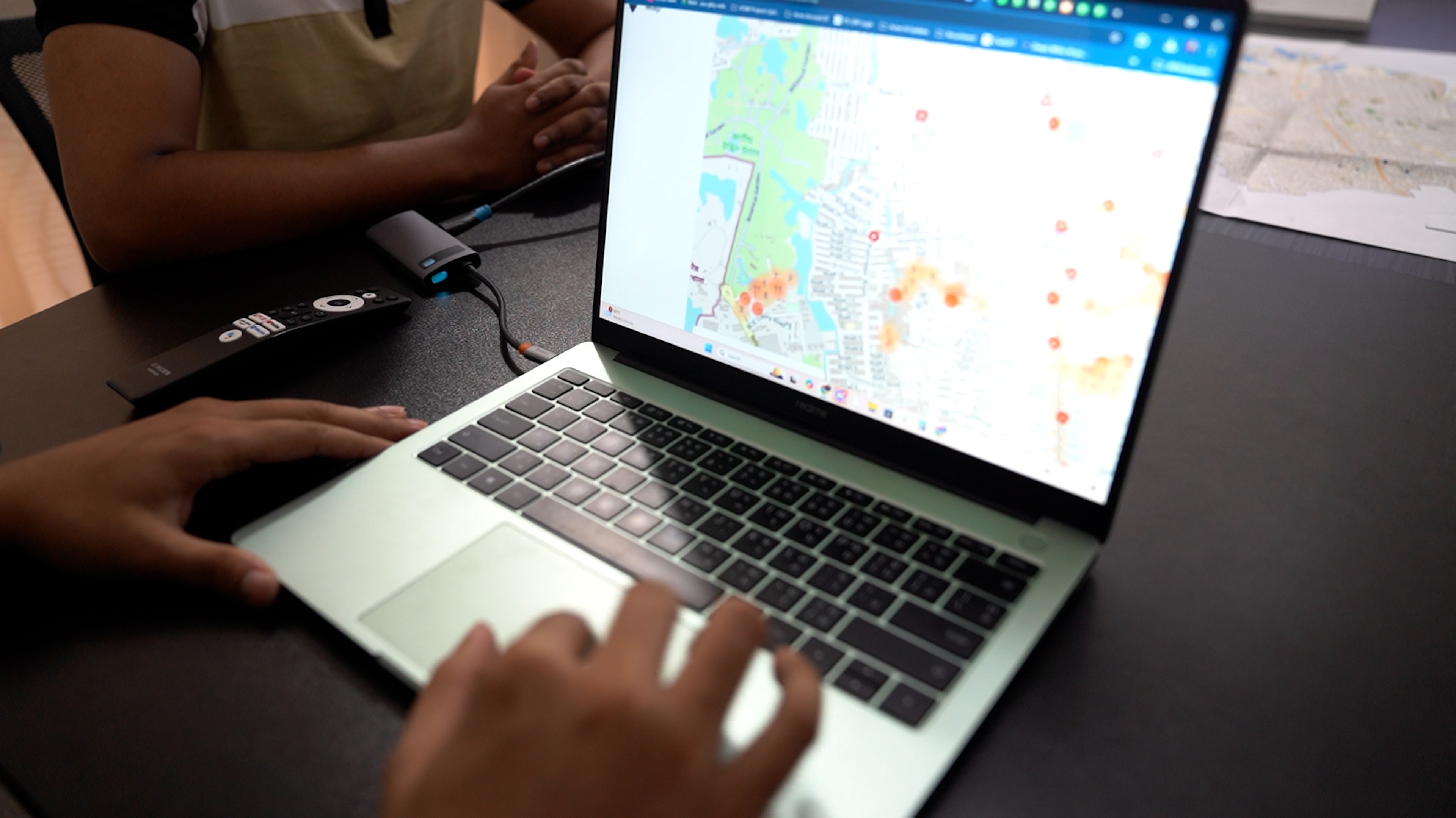
One of the most innovative elements of Dhaka Thrive is its dynamic Urban Vulnerability Dashboard. This tool visualizes the data collected through participatory mapping, integrating it with predictive analytics to highlight key risks such as flood zones, heat islands, and areas prone to disease outbreaks. The dashboard provides city planners, NGOs, and government agencies with actionable insights to prioritize interventions and allocate resources more effectively.
For example, in its initial phase, Dhaka Thrive mapped over 41 informal settlements, identifying critical vulnerabilities in areas like healthcare access and sanitation. This data has already informed targeted interventions by local authorities, ensuring that resources are directed to where they are needed most.
Collaboration and Impact
A key strength of Dhaka Thrive lies in its partnerships. Working closely with the Dhaka North City Corporation and the Ministry of Disaster Management, the initiative ensures that the data collected is integrated into official urban planning processes. Global collaborators, including the Humanitarian OpenStreetMap Team (HOT), have provided technical expertise to enhance the project’s scalability and impact.
The Road Ahead
As Dhaka continues to grapple with the challenges of urbanization, Dhaka Thrive offers a replicable model for inclusive and resilient city planning. By putting communities at the center and harnessing the power of geospatial technology, the initiative is not only transforming Dhaka but also setting a precedent for cities worldwide.
In a world increasingly vulnerable to climate and urban risks, Dhaka Thrive is a testament to the power of innovation, collaboration, and community-driven change.
By Rahul Mathew Nimmagadda, World Vision Bangladesh, Deputy Director - Resource Development.
Rahul Mathew is an international development leader with over 15 years of experience in resource mobilization, strategic partnerships, and communications. He leads fundraising and communications at World Vision Bangladesh, driving impactful programs for vulnerable communities. Passionate about mentoring and innovation, he fosters cross-sector collaboration and thought leadership in social impact.
Subscribe to see more content like this
Related Resources

Urban Resilience Provides Framework to Bridge Humanitarian and Development Divide
